FWI predicts how severe a wildfire is — not where one starts
In the Karst, 52% of wildfires are human-caused, 97.3% ignite below Europe's generic "High" FWI threshold, and 71% start with FWI below the median. A weather index alone detects only ~29% of them — so the KFWI adds a second component: where a wildfire is likely to start.
ML ignition probability
A spatial-temporal machine-learning model (AUC 0.89 under spatial cross-validation; 0.94 on out-of-domain Slovenian fires) predicts where a wildfire is likely to ignite — independent of the weather, but capturing seasonal patterns.
FWI severity classification
The Fire Weather Index — from live Copernicus-backed weather — rates how severe a wildfire would be if it ignited, using Karst-calibrated thresholds instead of the generic European EFFIS bins.
Key scientific findings
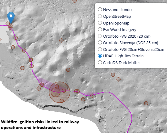
Hotspot memory dominates. Wildfires recur in the same places (Sgonico–Monrupino–Basovizza) — spatial memory is the strongest predictor.
Railways beat roads. Railway proximity (26%) outweighs road proximity (16%) — likely electrical sparks from trains and power lines.
Human-caused wildfires are more predictable. 84.9% detection for anthropogenic ignitions vs 66.2% for lightning.
EFFIS thresholds miss the Karst. 97.3% of wildfires occur below the European "High" threshold — local calibration is essential.
FWI ≠ occurrence. 71% of wildfires start with FWI below the median; FWI is excellent for severity, poor for ignition.
Seasonality, fixed. A corrected temporal sampling (Phillips et al. 2009) lifted summer vs. winter contrast from 0% to +38.8% and AUC from 0.918 to 0.934 (random split).