A plateau generally prone to wildfire
Distance to roads contributed 50.6% to the hazard model, followed by land cover (16.3%) and railways (16.1%). Climate and topography were less important.
67.4% of wildfires started within 50 m of roads (mean 52.5 m); 14.1% within 50 m of railways.
The two highest hazard classes cover only ~16% of the area, yet capture 41% of historical wildfires in the top class alone.
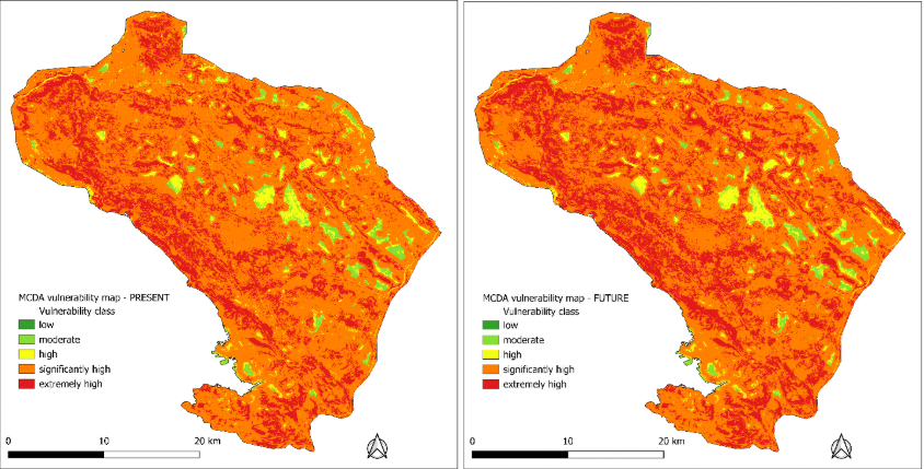
~93% of the plateau is classified as significantly or extremely vulnerable, and 98.6% of historical wildfires occurred there — which validates the map.
Historical wildfires concentrated in semi-natural land (40%) and broadleaf forest (37%); wildfire prefers drier S/SW slopes and ridges.
Over half of wildfires are of unknown cause; accidental and arson wildfires are proportionally more common on the Slovenian side, with peaks tracking drought years. Wildfire occurrence shows strong year-to-year variability, with peaks linked to droughts and heatwaves.